Space Shuttle Projects
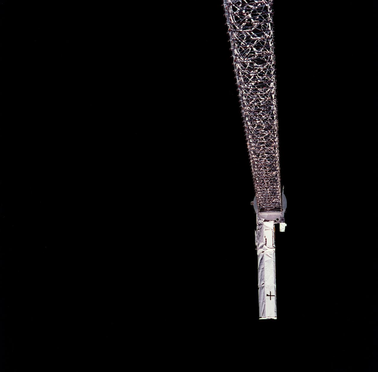
Launched February 11, 2000, the STS-99 Shuttle Radar Topographic Mission (SRTM) was the most ambitious Earth mapping mission to date. This photograph shows a 200-ft long (60 meter) mast supporting the SRTM jutted into space from the Space Shuttle Endeavour (out of frame). Orbiting some 145 miles (233 kilometers) above Earth, the giant structure was deployed on February 12, 2000 and its C-band and X-band anternae quickly went to work mapping parts of the Earth. The outboard antennae can be seen near bottom right. The SRTM radar was able to penetrate clouds as well as provide its own illumination, independent of daylight, and obtained 3-dimentional topographic images of the world's surface up to the Arctic and Antarctic Circles. The mission completed 222 hours of around the clock radar mapping, gathering enough information to fill more than 20,000 CDs.