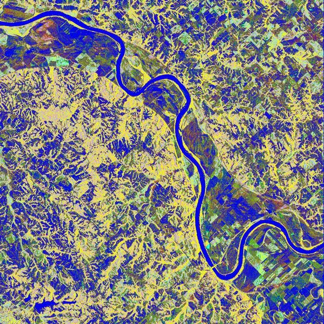
Space Radar Image of Missouri River, Glasgow, Missouri
This is a false-color L-band image of an area near Glasgow, Missouri, centered at about 39.2 degrees north latitude and 92.8 degrees west longitude. The image was acquired by the Spaceborne Imaging Radar-C and X-band Synthetic Aperture Radar (SIR-C/X-SAR) aboard the space shuttle Endeavour on its 50th orbit on October 3, 1994. The false-color composite was made by displaying the L-band (horizontally transmitted and received) return in red; the L-band (horizontally transmitted and vertically received) return in green; and the sum of the two channels in blue. The area shown is approximately 37 kilometers by 25 kilometers (23 miles by 16 miles). The radar data, coupled with pre-flood aerial photography and satellite data and post-flood topographic and field data, are being used to evaluate changes associated with levee breaks in landforms, where deposits formed during the widespread flooding in 1993 along the Missouri and Mississippi Rivers. The distinct radar scattering properties of farmland, sand fields and scoured areas will be used to inventory floodplains along the Missouri River and determine the processes by which these areas return to preflood conditions. The image shows one such levee break near Glasgow, Missouri. In the upper center of the radar image is a region covered by several meters of sand, shown as blue regions below the bend in the river. West (left) of this dark area, a blue gap in the levee tree canopy can be seen, showing the area where the levee failed. Radar data such as these can help scientists more accurately assess the potential for future flooding in this region and how that might impact surrounding communities. http://photojournal.jpl.nasa.gov/catalog/PIA01744