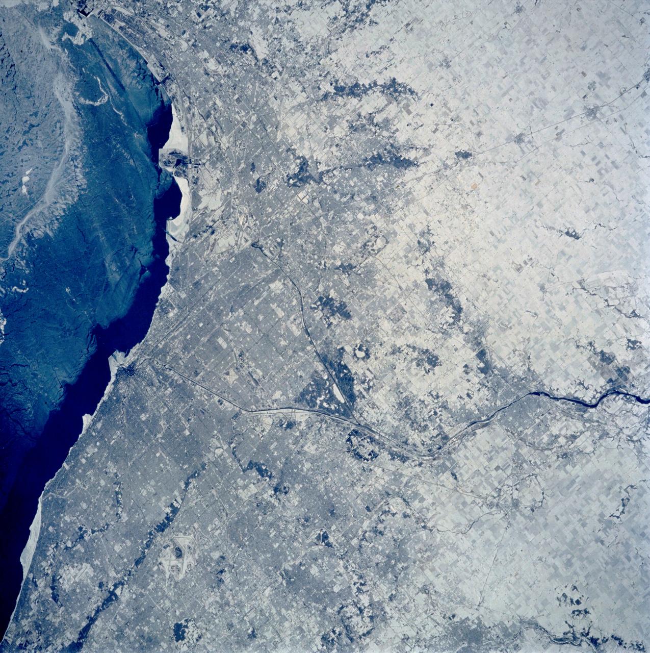
Chicago, Illinois as seen from STS-60
STS060-103-089 (3-11 Feb. 1994) --- The Chicago, Illinois area is in this northeast looking low oblique view obtained in February, 1994. Lake Michigan, a good portion covered with ice due to the very cold winter weather that has plagued this region since early December, 1993, can be seen to the east of the city. The Des Plaines river is visible traversing northeast to southwest through the center of the city. O'Hare International Airport and the Glenview Naval Air Station can be seen to the north of the Des Plaines River. Midway Airport is visible just to the south of the river. Chicago is a port of entry; a major Great Lakes port located at the junction of the St. Lawrence Seaway with the Mississippi River system; the busiest air center in the United States; and an important rail and highway transportation hub. Chicago is known for large grain mills and elevators, iron and steel works, steel fabrication plants, stockyards, meat-packing establishments, and printing and publishing houses. In the early days of settlement, the narrow watershed between Lake Michigan and the Des Plaines River (draining the Mississippi River through the Illinois River), offered an easy portage that led explorers like Father Marquette and Louis Joliet and others to the Great Central Plains. Fort Dearborn, a military post was established in 1803. By 1860, the railroad connected Chicago to the rest of the country and the city became a great mid-continent shipping and receiving center. In 1871, the city built of wood, was almost entirely destroyed by a great fire. After the fire, Chicago was built as a city of steel and stone. During the World's Colombian Exposition held in Chicago in 1893, the city became a leading architectural center. It was here during the Exposition that the skyscraper came into being. Chicago continues to lead the way in this type of architectural structure as is evidenced with the completion of the Sears Tower in 1974.